|
Snapshot |
|
|---|---|
|
Location |
Argelia, Antioquia Department, Colombia |
|
Ownership |
100% owned |
|
Deposit Type |
Intermediate sulfidation epithermal |
|
Primary Minerals |
Gold and Silver |
|
Stage |
Early Exploration |
Overview
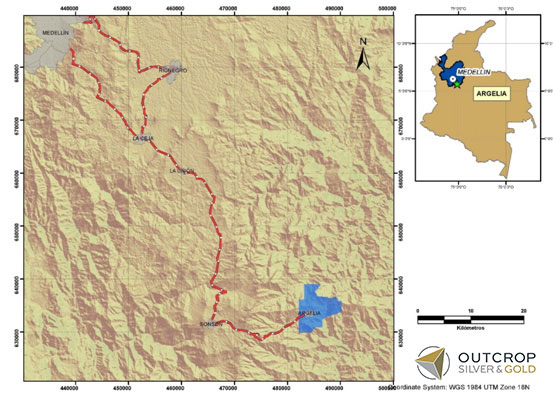
The Argelia project comprises 4,355 ha of applications located in Antioquia Department. The project is readily accessible by a combination of paved and all-weather gravel roads. It is located approximately 75 kilometers southeast of Medellín, by car 111 km to Sonsón on paved National Route 56 and then 33km on unpaved roads to the town of Argelia, and then 3.5km on gravel roads to the project.
History
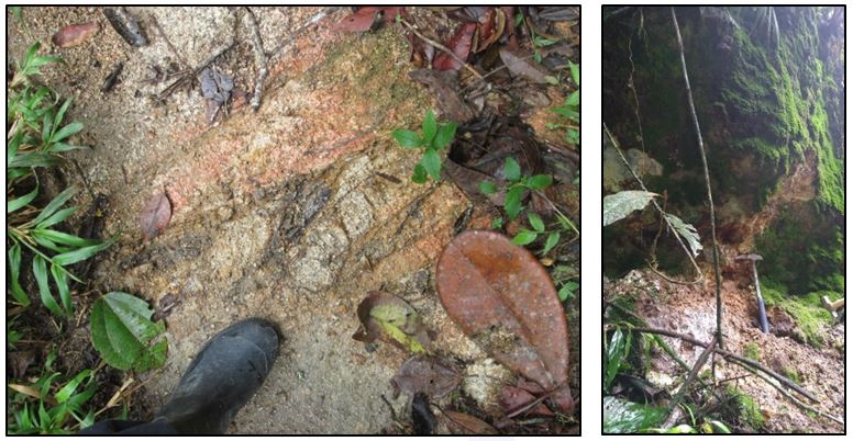
Argelia has a long mining tradition. Public records show that a private British mining company mined and produced gold on the project prior to 1950. The workings presumed to represent this activity have two levels spaced approximately 100 m apart in elevation.
Geology
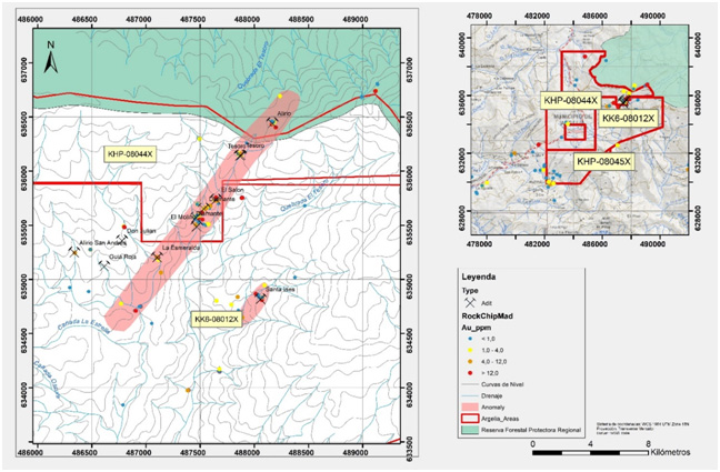
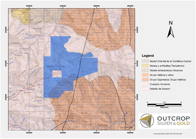
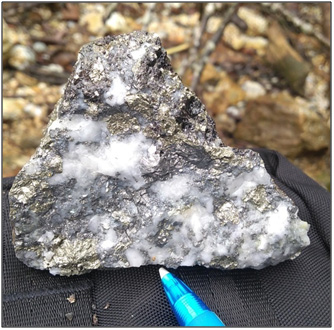
Argelia consists of intermediate sulfidation epithermal veins with silver and gold mineralization hosted by the Sonson batholith that intruded the metamorphic rocks of the Cajamarca Complex. The veins strike at an oblique angle to a shear zone and may be emplaced in dilational structures, secondary to the main shear. The shear is up to 4 km long and 2 km wide. Within the shear is a fault zone of at least 2.5 km strike and 0.25 km width containing at least three sub parallel veins or fault-veins with an azimuth between 225° and 245°; vein widths range from 0.25 to 2m.
Project fractures and faults are associated with the Palestina Fault System. Plutonic bodies intrude this fault system. The Palestina system presents dextral faulting, with strong tectonic influence in the evolution of the Sonsón batholith and associated project fault systems.
Exploration
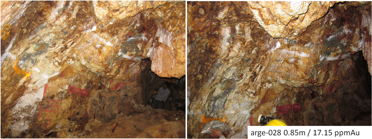
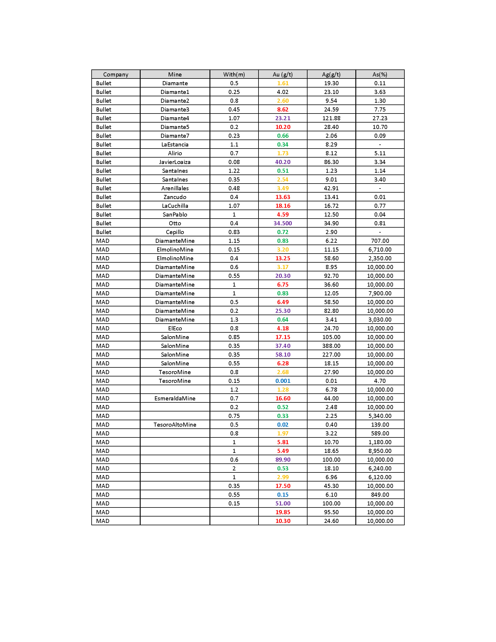
Between 2010 and 2013, Bullet Group performed exploration activities in all three applications, leading to the identification of a series of adits and outcrops. Miranda (Outcrop) performed reconnaissance work during the last quarter of 2013, visiting six (6) tunnels, namely the Diamond, Molino, Alirio, Santa Ines, Tesoro and Salon mines. This allowed for confirmation of the area’s potential. In 2018, prospective work was restarted, leading to the identification of new outcrops and abandoned adits.
The veins are interpreted as intermediate sulfidation epithermal. The veins strike at an oblique angle to a shear zone and may be emplaced in dilational structures, secondary to the main shear. The shear is up to 4km long and 2km wide. Within the shear is a fault zone of at least 2.5km strike and 0.25km width structural and containing at least three sub parallel veins or fault-veins with an azimuth between 225° and 245°, Veins widths range from 0.25 to 2m.
Future Plans
Exploration activities required prior to any drilling include but are not limited to defining the extensions of the structural corridors – the number of veins present in each, their features, structural controls, ore shoot characteristics, geochemistry, alterations, and related data.
Outcrop plans to engage in social and communication works with the local authorities and the community in order to advance the project towards a public audience that will allow us to tittle key applications.
Outcrop is seeking a joint venture partner agreement on Argelia.
Project Maps and Photos